Ant HillRuss's StreetLee's WayEvan's HeavenMooseDon's DescentFirst CreekNorth Bowl Chute/NBCEast Rim ChutesChicken NuggetsThe Nose of East RimWhitey'sEast Rim FaceMoe-MentumNorth Bowl FaceSchmidt's ChuteSpaceElephants' GraveyardNo NameBigfoot T-Bar Area


Home > North Bowl Area > Don's Descent

Don's Descent

Clicking on the photos enlarges them.  Photos are taken as you come down the hill.  They have been taken over several years, so conditions shown will vary depending on what was happening the day the particular photo was taken.  Photos looking back up the hill will be described as such.


Overview

  • Rated:  
  • Type of trail:  Steep, treed run.  Dense trees.  
  • Head down the Ant Hill, pass Moe-Mentum on the right and look for either a small opening on the right labeled First Creek and cut in right there (not continuing along the track), or proceed along Russ's Street for the next opening in the fence prior to Moose.

View approaching Don's Descent:

A link to an aerial picture of East Rim's eastern side, showing Don's Descent and others:

Photo by Brian Schott for the Whitefish Visitor's Bureau, linked from Facebook:

Here's an aerial perspective of Whitefish Mountain Resort's East and North sides of the mountain,
something you could only see from the air.  
We put the named runs on the photo, plus a few nicknames.  Did we mess anything up?  
Do you have other names for special zones you ski that aren't on the trail map?

Posted by Explore Whitefish on Monday, March 18, 2013

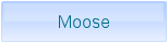
Lower part of area, seen from Moose (need more pictures..):